Introduction
Scott Ashford joined the College of Engineering in 2007. On his first day, the new head of the School of Civil and Construction Engineering noticed a memo on his desk. It advised him to eliminate the geomatics program upon the retirement of Robert Schultz, the legendary professor who had played a pivotal role in the education of countless surveyors and engineers throughout the Pacific Northwest over his 56-year teaching career.
“As a professional engineer, this did not make sense to me,” said Ashford, who has served more than 11 years as Kearney Dean of Engineering. “There were so many new surveying and data capture techniques being developed, and I thought students deserved more geomatics education and research, not less.”
After seeking valuable guidance from industry partners, Ashford settled on his course of action.
“We doubled down and threw our full support behind geomatics,” he said.
From the brink of extinction, the geomatics program quickly reversed direction and began growing into today’s dynamic and flourishing curriculum.
“Scott understood that the field was changing, and that there was much to gain by Oregon State’s engineering program getting behind geomatics,” said Michael Olsen, CH2M Hill Professor of Geomatics.
A new geomatics for a new century
Geomatics, a field traditionally concerned with conventional surveying and mapping, has since expanded to encompass collecting and interpreting spatial coordinates using tools like satellite navigation, remote sensing, gravimetry, lidar, 3D modeling, and uncrewed aircraft systems. The data captured by these tools and other emerging technologies are used to re-create physical environments, objects, and structures in high detail. The results are applied widely in diverse industries, including construction, architecture, gaming, virtual reality, film, and heritage preservation.
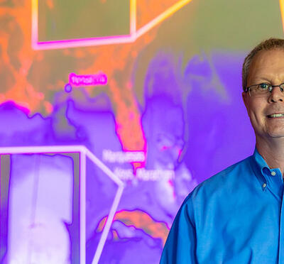
CH2M Hill Professor of Geomatics
Blue Primary, Yellow Secondary
“Everything we build or monitor on Earth requires precise spatial coordinates,” said Chris Parrish, professor and Jim and Billie Plasker Faculty Scholar in Geomatics. “I think we lose sight of just how much of our daily lives is based on knowing with high precision where people, vehicles, equipment, and resources are in relation to one another. All of that falls under the umbrella of geomatics.”
Geomatics may play a central role for many functions that industry, government, and the public rely on, yet it typically operates behind the scenes, says Olsen.
“It’s as if geomatics is everywhere and nowhere at the same time,” he said. “Countless people are doing work that relies on geomatics, but without even realizing how vital it is for things like GPS navigation, satellite imagery, robotics, urban planning, environmental monitoring, airline flight routing, autonomous vehicle operations, agriculture, marine navigation, disaster relief efforts, and even social media location tagging.”
Meeting the demand for a growing geomatics workforce
Despite the high demand for geomatics services, there’s a shortage of experts in the U.S., most notably in geospatial fields, which threatens to slow or even halt progress in defense capabilities, infrastructure development and maintenance, disaster response, cybersecurity, and other vulnerable areas.
Olsen, who joined the College of Engineering as an assistant professor of geomatics in 2009, was the first geomatics faculty member hired by the college in decades, representing the vanguard of the discipline’s resurgence.
“The good news is that more people are starting to realize the importance of geomatics,” Olsen said. “More students are attracted to our program because of the quality of our faculty, while the severe shortage of advanced-level geomatics experts in the country in both private sector and government positions means there are a lot of positions that need to be filled. More faculty are interested in coming here because they understand that a growing program like ours can benefit their own research and expand opportunities for funding.”
The geomatics group currently has three tenured faculty, three teaching faculty, three research faculty, four research staff members, 20 graduate students, and 44 students enrolled in the undergraduate minor. In 2024, six master’s degree students and four doctoral students graduated from the program.
“Many of our students naturally gravitate to the field because it’s technical and very hands-on,” said Chase Simpson, assistant professor of geomatics practice. “They also understand how geomatics applies to their majors, like coastal engineering, infrastructure, and transportation.”
Liam Crowley took his first surveying course a year into his undergraduate civil engineering program at Oregon State. He knew little about geomatics, but he liked the field well enough to declare a minor. After he graduates in June, Crowley plans to make surveying a central part of his engineering career.
“One of the reasons I’ve become so interested in the subject is that before anything gets built, a site has to be surveyed, and that makes the work an important contributing factor in any building project,” Crowley said. “I also like collecting the data with my own hands, solving problems, and then turning the data I gather into information that will be used in a project’s next steps. I also really enjoy working outdoors, so surveying is a great match for me.”
Hunter Mitchell earned a bachelor’s degree in physical geography at Penn State in 2019, then worked as a field technology engineer in Richmond, Virginia. In 2023, he came to Oregon State to get an advanced degree in geomatics.
“As an engineer, I never knew how all of the data that we depended on was collected, so when I found out about geomatics, I was fascinated by the intersection of the various disciplines that made our work possible,” Mitchell said.
But instead of collecting his master’s degree in June as originally planned, Mitchell decided to stay on in Corvallis to pursue a doctorate in geomatics.
“The environment at the university is so supportive and collaborative, and the program strikes a good balance between the theoretical and practical sides of geomatics,” Mitchell said.
The College of Engineering is now considering the addition of an undergraduate degree program covering geodesy, geomatics, and geospatial engineering.
“It’s an exciting time to be in this field,” Parrish said. “Every part of it seems to be growing, and students at all available degree levels here frequently receive multiple job offers before they graduate.”
Leading the charge to modernize the National Spatial Reference System
Yet another reason for optimism is the $6.5 million, five-year grant Oregon State received in 2023 to assist with modernizing the National Spatial Reference System. Funding for the project comes through the National Oceanic and Atmospheric Administration’s National Geodetic Survey as part of nearly $20 million awarded in its Geospatial Modeling Grant competition.
“The NSRS is the national system of latitude, longitude, height, and gravity developed and maintained by the National Geodetic Survey,” Parrish said. “Everything that requires spatial coordinates relies on its accuracy, like surveying, autonomous vehicle navigation, precision agriculture, and ship navigation. Before our current satellite-based positioning technologies, we could generally ignore the movement of the Earth’s crust when computing 3D spatial coordinates of points. However, our positioning technologies are now precise enough that we need time-dependent coordinates that account for the motion of the tectonic plates.”
The last major update to the NSRS occurred more than 40 years ago, so the modernization is long overdue to meet current demands for accuracy, Parrish said.
Among Oregon State’s primary objectives are developing and testing new global navigation satellite system, or GNSS, software tools, assisting state agencies and industry in transitioning to the modernized NSRS, and developing a geodetic workforce for the future. The work will be coordinated at the new Geospatial Center for the Arctic and Pacific, based at Oregon State.
Additional responsibilities include outreach and education, such as short courses, certificate programs, workshops, and publications.
“People have a lot of questions, so we’re working with our state and local government and industry partners to help the geospatial community prepare for NSRS modernization,” Parrish said.
Olsen emphasized that industries reliant on the NSRS should stay current with the progress of the modernization. For example, problems could arise when autonomous vehicles cross a state boundary and switch real-time GNSS networks if one state’s coordinates have been updated while the other’s are still in transition. The conflicting data could create mishaps, such as improper lane positioning, navigation mistakes, and even collisions.
The grant is already leading to positive outcomes for the program, Parrish noted.
“It’s increased our visibility at a national level,” he said. “At conferences, we’re recognized as a leading geomatics program, and that attracts attention from potential students and faculty. People want to talk to us. They want to talk to our students. It’s strengthened our active collaboration with the National Geodetic Survey, and that opens up even more opportunities for our students to work on projects with some of the world’s leaders in their fields. The trajectory of geomatics and the opportunities for our students really do seem limitless.”