Introduction
The radar tower stretches into the sky. Walking up the beach, Annika O’Dea and Alex Simpson point it out, a single structure overlooking the dunes. A kilometer away, its spinning top is just barely visible in the foggy October morning.
O’Dea and Simpson are doctoral students in the coastal and ocean engineering in Oregon State University’s College of Engineering, and they’ve come to a remote beach near Santa Maria Valley in Central California to study the coastal ocean. Their research group, led by Merrick Haller, professor of coastal and ocean engineering, uses remote sensing technology to capture interesting coastal phenomena, like rip currents or massive underwater waves that mix the water below the surface.
O’Dea and Simpson walk to a familiar spot on the beach just shoreward of the radar tower. Haller’s team installed two radar towers, one of which stands over 100 feet tall, along the California coastline as part of the Inner Shelf Dynamics Project. Six weeks into their field experiment, they set-up their research site for the day: two beach towels, notebooks, a bag of snacks, and a research drone. Now it is time for them to wait for the boat.
Today, O’Dea and Simpson are coordinating with researchers from the Applied Physics Laboratory to take simultaneous measurements from the air and sea to map rip currents. The collaboration is part of a growing movement to partner seagoing scientists with remote sensing researchers, and a testament to the power of directing field experiments from the sky.
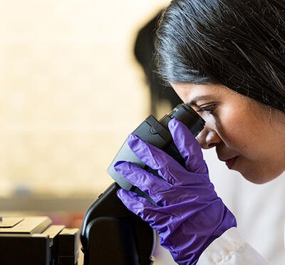
Simpson and O’Dea sit down on the sand and make themselves comfortable. It’s 8 a.m., and they sip coffee from thermoses. O’Dea inspects an image on her phone’s screen, the latest from the radar tower behind them. The team has a live-feed of radar images online for anyone to use, and O’Dea searches the picture from just a few minutes ago for any signs of rip currents.
Rip currents are a well-known beach hazard in coastal communities and are typically strong, narrow currents that carry water quickly out to sea and away from the beach. “People learn about rip currents from a young age,” says Simpson, who grew up in San Diego. “You learn how to escape them by swimming parallel to shore.” Still, the currents can take many people by surprise, and are responsible for 80 percent of lifeguard rescues per year, according to the United States Lifesaving Organization.
For scientists, rip currents can be frustrating to measure because they crop up in different locations on the beach depending on the oceanographic conditions and shape of the shifting sand below. Installing an ocean buoy with scientific instruments is a gamble; it's not guaranteed that a rip current will pop up in the right place for the buoy to record it.
Radar offers an alternative: radar can spot rip currents by picking up on the change in water speed associated with the fast-moving currents. Rip currents show up in the radar images like “a big mushroom cloud,” says Simpson, and the radar's broad footprint across seven miles of coastal water helps them to capture the full extent of the rips. In one case, they found a rip extending almost a half a mile offshore, a rare and massive event mentioned as possible in scientific literature, but never witnessed by Haller’s team before.
Haller and his research team have evolved from merely finding rip currents and other oceanographic phenomena to broadcasting their results for other scientists. “Anyone who's out on the boat can pull up our website and look at the radar images in real time,” says Simpson. This allows researchers to drive their ships to oceanographic features they couldn’t know were there without eyes from above.
On the beach that morning, a small research boat appears offshore. Onboard scientists from the Applied Physics Laboratory set up their oceanographic equipment. Today, O’Dea and Simpson will direct the boat to rips, and at the same time, pilot the team’s latest remote sensing tool: a video camera-equipped drone.
The drone has a white body with four propellers and a swiveling camera on its underbelly. Simpson starts up the drone from the control panel, peering at a screen showing the camera output. Drones have been used increasingly in recent years, says Simpson, “but it's a little bit of an arms race to use them in the coolest way.” She says that they selected their drone for its superior imaging capability and ease of landing, and their goal is to use drone footage to provide context for their sometimes-cryptic radar images.
As Simpson hovers the drone a dozen feet above, the camera rotates while the platform stays perfectly still, reminiscent of an owl turning its head. In the barren landscape surrounding them, the drone seems almost sentient. With all the data platforms ready – the radar, boat, and drone – the sampling begins.
Haller has said that one of the constant struggles in any field experiment is having no control over when and where oceanographic features occur. Even in a location where his team has mapped ocean fronts for weeks in preparation for collaboration with ship-board experiments, there is no telling what the ocean will do when the ship arrives.
“Mother nature isn't simply repeatable,” says Haller. “Even though you observed something over a certain amount of time, it doesn't mean things can't change.”
Haller says the solution to the unpredictability is patience and an ability to collect piles of data. Remote sensing tools like radar and drones capture thousands of images a day, many of which may be unhelpful for their research. But having around-the-clock surveillance is what makes radar so compelling, and gives Haller and his team the necessary time to wait out the occasional dull day.
At first, Simpson and O’Dea seemed to be striking out on the beach. Simpson pilots the drone up and down the shoreline, inspecting for rip currents, but finding none. Simpson points to the boat on the drone control panel, driven by Jim Thomson. “Where he's surveying, we would want to be seeing rips. We just don't right now.”
Simpson and O’Dea drone on into the late morning before finding a signal, when finally, Simpson, squinting at the drone’s video output, turns to O’Dea and says: "I think I'm coming up on something.” O’Dea leans toward the screen and lets out an excited “Oh, yeah!” She points out the color difference of the water, a plume of greenish water coming offshore into the darker blue, a rip current slipping silently under the oncoming waves. The shape of the plume looks like a cauliflower head, with foam accumulating on the edges, rimming it with white. Despite the dangerous power of the current, it almost seems beautiful, like a flare leaving the sun, shooting light and energy into the depths of space.
Simpson hovers the drone over the rip, and O’Dea instructs the boat to shift north. The boat drives right over the top of the rip plume, trailing its temperature and salinity sensor through the water below. The boat’s data will be a fascinating look into how rip currents inject sand and particles into deeper waters, and the drone footage gives a qualitative snapshot of what the radar and boat are measuring.
Haller says that this type of simultaneous sampling of both ‘synoptic’ radar images and in-the-water ‘point measurements’ is priceless for coastal research.
“I think everyone has come to the realization that having the synoptic picture at the same time as the highly detailed, in-situ point measurements is the only way to tell a complete story,” says Haller. Indeed, others have taken notice; his team has collaborative field experiments lined up for the next five years.
Haller acknowledges the limits of radar. Depending on wind conditions, the sea surface may be too calm or too rough to make out meaningful signals, and the method lets some instances of rips fall through the cracks.
Still, when other sampling methods must go home, the radar measurements continue. On the beach, the wind begins to pick up in the afternoon, making the waves too hazardous for the boat to keep sampling. The drone’s batteries are getting low, so O’Dea and Simpson land the drone and pack up their supplies in the afternoon sun, shaking off sand from beach towels and retrieving discarded coats. It’s time to go home and begin the long process of combing through troves of footage.
As they walk back down the beach and the boat speeds away toward the harbor, the researchers leave no trace of their temporary laboratory. And yet the radar tower remains in the distance; it's top spinning, a watchtower overlooking the shore.