Oregon’s natural beauty is renowned the world over, from its vast expanses of wild forest to its majestic coastline. But living side by side with nature also means living with a certain element of danger from natural hazards, like earthquakes, wildfires, tsunamis and ocean swells, coastal erosion, and landslides.
Within the College of Engineering, a number of faculty members devote a substantial portion of their research effort to developing a better understanding of these threats. They also devise creative solutions to protect our built environment. By helping to design stronger, more resilient infrastructure, their work is making communities safer — in Oregon and around the world.
One natural hazard that has engineers bracing for impact, particularly in Western Oregon, is the inevitability of a magnitude-9.0 earthquake along the Cascadia subduction zone. Extending more than 600 miles from Washington to California — including the entire length of Oregon’s coastline — the subduction zone is where one tectonic plate thrusts itself under another at the continental shelf.
Seismologists say that megathrust events (massive earthquakes, often accompanied by tsunamis) occur here about once every 500 years on average — the last was in 1700 — but the interval between these events varies, and we can’t predict exactly when the next one will happen. Experts give a 50-year probability of about 10%.

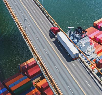
Armin Stuedlein performs blast-induced liquefaction research, critical to stabilizing the ground beneath Portland International Airport in the event of a major earthquake.
Armin Stuedlein, professor of geotechnical engineering, is helping to make sure that at least one of the runways at Portland International Airport will survive the shaking, whenever the Big One comes.
“Our recovery really hinges on our ability to restore critical infrastructure networks, and that’s where the Port of Portland comes in,” Stuedlein said. “Having a usable runway immediately following this earthquake will be critical for bringing in supplies from other parts of the nation and putting our community in position to respond quickly.”
The Port of Portland is developing a plan to strengthen the soil under one of the runways at PDX. Stuedlein’s team was enlisted to figure out how the ground will behave in a major earthquake, using a technique called blast-induced liquefaction. This technique employs explosives sunk deep into boreholes to simulate the effects of a quake, causing the sandy, saturated soils beneath the surface to act like a liquid.
Over three days in October 2018, at a test site about a kilometer away from the airport’s south runway, Stuedlein’s team blasted the soil. They observed ground motion characteristics and soil responses using sensors placed at varying depths to a precision of about 1 mm.
“We were able to get a 360-degree view of how liquefaction is triggered at very large depths and what the corresponding consequences would be, in terms of displacement,” Stuedlein said. “Our work demonstrates that this technique is viable in relating the earthquake performance of soils, and we can develop fairly complex soil dynamics from our experimental technique. These soil dynamics were used by the port’s engineers to design their mitigation strategy below that south runway.”
The port engineers were already leaning toward a technique, called deep-soil mixing, that involves injecting water and cement slurry deep into the soil. After treatment, the soil’s composition changes into something like an artificial sandstone: more stable and, most critically, not subject to liquefaction.
Without the benefit of Stuedlein’s blasting experiments, the port engineers most likely would have applied the deep-soil mixing to a depth of 100 feet. But the research told them the critical depth was only about half that. With construction costs running about $1 million per foot, Stuedlein estimates the research potentially saved taxpayers as much as $50 million. The Port of Portland contributed $350,000 for the study.
“That puts the rate of return, or the return on investment, at about 50- to 100-to-1,” Stuedlein said.
Occurring far more frequently here than earthquakes, wildfires are another major natural hazard — one that Oregon faces with dismal predictability. Every summer, seasonal firestorms consume tens and hundreds of thousands of acres statewide. They destroy wildlife habitat, pollute rivers and streams, and poison the air with smoke. They uproot communities and, in some cases, can wipe entire towns off the map.
David Blunck, associate professor of mechanical engineering, has collaborated on numerous research projects probing the mechanisms by which wildfires spread. Better understanding in this area can lead to improved methods of firefighting and prevention.
Oregon’s worst fire season on record was in 2020. Over 1.2 million acres burned, killing 11 people and destroying more than 3,000 structures — mostly family homes. Unfortunately, that record is likely to be broken, as global warming and increasing drought continually exacerbate fire risks.
“I think that summer, unfortunately, was a wakeup call to a lot of us in the western part of Oregon, that wildfires can happen close to home,” Blunck said.
Much of Blunck’s research examines the formation and release of firebrands, embers from burning fuels (like sparks from a campfire) that are carried through the air to start new fires, up to several miles away. Fighting fire with fire, Blunck ignites trees of various species and sizes in a controlled setting to observe burn characteristics. Firebrands land on large sheets of fireproof fabric, where they leave telltale char marks. These marks can then be quantified and analyzed with digital imaging, and the resulting data can be used to inform computer wildfire models.
“This technique we have developed to estimate the total number of firebrands, no one’s done that before,” Blunck said. “Collectively, the firebrand and wildfire research community is starting to apply this technique, and hopefully they can improve on it. But I think it’s a great foundation.”

Erica Fischer’s work includes developing and testing sensors to detect damage to water pipes caused by wildfire.
Wildfires that devastate mountain communities also have the potential to foul the water distribution systems running underneath residential structures. But knowing which water pipes have been affected is challenging. Erica Fischer, assistant professor of structural engineering, is working with a team of engineers and scientists to develop and test sensors that can easily indicate if water pipes need to be replaced following a fire.
“If the pipe is completely melted, obviously it needs to be replaced,” Fischer said. “Where the sensor can be really helpful is when the pipe isn’t melted. It doesn’t have visual damage. Is there actual damage? Are contaminants migrating into the water at that point?”
Fischer’s team has been testing different types of pipes by heating water inside them to different temperatures and then having the water tested. The team then uses the data to construct numerical models of pipes in different environmental settings.
Season 11 of “Engineering Out Loud,” the College of Engineering podcast, is dedicated to engineering for natural hazard impacts. Listen now on your favorite podcast app and to learn more about the projects highlighted in this story and others, visit engineeringoutloud.oregonstate.edu.